

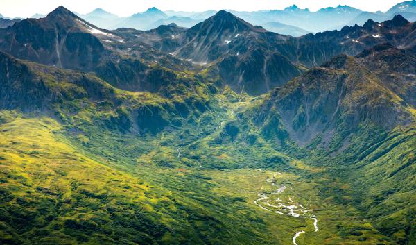
Alaska's Kuskokwim River is a dynamic force and the lifeblood of many rural communities along its banks. Flooding and erosion change the river’s course naturally over time, but climate change is accelerating this process. Rising temperatures alter spring river-ice breakup, cause more extreme weather events, and accelerate permafrost thaw. These factors can lead to higher flows and unstable banks that contribute to erosion, threatening the infrastructure and livelihoods of communities along the river. The communities of Akiak and McGrath, Alaska have taken steps to reduce the impacts of erosion.
Reading time | 9 minutes
Management Goals | Protect communities from riverbank erosion in Alaska
Audience | Rural development, land managers, communities
Project Contact | Brett Nelson, Alaska State Conservation Engineer, USDA Natural Resources Conservation Service
Project Area | Akiak and McGrath, Alaska
Funding | See funding section
Bank erosion and climate change on the Kuskokwim River
There are several factors that contribute to bank erosion on the Kuskokwim River:

- Longer Open-Water Season: Rising temperatures have reduced the river-ice season on the Kuskokwim River. In the last ten years, spring ice breakup has occurred about a week earlier on average than it did in 1924. A shorter river-ice season equates to a longer open-water season. Coupled with increased precipitation, a longer open-water season could lead to more floods and hasten erosion on the Kuskokwim River.
- Dynamic Ice Breakup and Flooding: Dynamic river-ice breakup can worsen spring erosion. Dynamic ice breakup occurs when an above-normal snowpack, thick ice, and a cold spring are interrupted by sudden warmth. Rapid melting of snow and ice can raise water levels quickly. Thick ice can then break into large chunks that have the potential to form ice jams and block river flow. Subsequent flooding and riverbank gouging can cause significant erosion.
- Ice Jams: Ice jams that cause rapid flooding can be dangerous for communities. In 2009, the water level in Eagle, Alaska rose more than 30 feet in 48 hours due to an ice jam downstream. In the same year, Akiak, Alaska was inundated by 3 feet of water. In some rural communities, subsistence harvesters have reported that river-ice breakup has become more dynamic and unpredictable in recent years, although the effect of climate change on the frequency and intensity of dynamic river-ice breakup events is not fully understood.
- Permafrost Thaw: When permafrost adjacent to rivers thaws, the banks become unstable and more susceptible to erosion, especially during floods. Up to a quarter of near-surface permafrost in Alaska is anticipated to disappear by the end of the 21st century.
Riverbank erosion and flooding in the rural communities of Akiak and McGrath can be devastating because they are accessible only via boat or airplane. These communities rely on long supply chains that can be interrupted by severe weather, mechanical issues, and other factors. This can increase the difficulty and costs associated with recovering from severe floods and riverbank erosion.
Relocating structures reduces losses in Akiak
Akiak, a riverside community of nearly 500 residents located 42 miles from Bethel, relies on the Kuskokwim River for subsistence resources, transportation, and water. However, the river is also threatening to erode portions of the community. Intense storms in 2012 eroded 100 feet of riverbank in a single day. In May 2019, a flood triggered by an ice jam eroded a one-mile stretch of the riverbank inland by 75 to 100 feet in a single day. This event destroyed smokehouses and brought the river within a few feet of six homes.
Housing is already scarce in Akiak. The loss of six homes would threaten lives and livelihoods in the community. In response, the Akiak Native Community worked with federal and state agencies to begin planning to relocate homes and infrastructure away from the rapidly eroding bank. The community turned to the USDA Natural Resources Conservation Service (NRCS) Emergency Watershed Protection (EWP) program for assistance with relocating structures to higher, safer ground.
The COVID-19 pandemic complicated plans to relocate structures. Limited air-freight options made it difficult to acquire the necessary equipment and materials. Despite these challenges, the Akiak Native Community worked with Kokarmiut Corporation and the City of Akiak to complete the project with a team made up entirely of Akiak residents, thus limiting community exposure to COVID-19. By 2023, Akiak had successfully relocated the six structures, protecting families from the encroaching river.
Bank stabilization protects McGrath from accelerated erosion
McGrath is a community of 300 residents located 220 miles northwest of Anchorage. The community is on an oxbow bend of the Kuskokwim River. As such, floods are not uncommon. In May 2005, the community experienced a flood accompanied by high winds and waves. In some areas, the community saw erosion up to 100 feet inland. A levee that protected McGrath from flooding was also damaged in the flood and nearly breached. This put the community at heightened risk of future flood damages and was a compelling reason for bank stabilization in the vicinity of the levee. Beyond flooding, the community loses around 10 feet of bank per year due to the force of flowing water alone.
Bank erosion put homes, buildings, and the city's water treatment plant at risk. For assistance with preventing further erosion, the City of McGrath partnered with NRCS on three separate EWP projects –the same program that funded the relocation of structures in Akiak. This partnership focused on constructing a riprap revetment (rock wall) that could strengthen the riverbank and prevent erosion. The revetment was constructed along 2,000 feet of riverbank to shield buildings and infrastructure, including City Hall, from erosion and to protect the community’s flood-proofing levee. This work was completed between 2010 and 2014. A nearby rock quarry helped facilitate this part of the project.
In 2022, the third EWP project constructed a bank key to prevent the river from flanking the existing revetments. The project also built stream barbs, structures that extend into the river channel from its bank. These barbs are angled upstream to redirect the flow of water away from the bank, preventing erosion along an additional 2,000 feet of bank. The revetment and stream barbs protect 4,000 feet of shoreline, shielding most of McGrath from the force of the river.
Expanding erosion protection efforts
Although EWP funds helped protect McGrath and Akiak temporarily, residents recognized the need for further action to ensure long-term community safety. In 2022, the Akiak Native Community received additional funding through the Watershed and Flood Prevention Operations (WFPO) program. This program can address community relocation needs beyond what is deemed an “imminent threat.”
The City of McGrath is also working with the NRCS to continue safeguarding the community from erosion. Like Akiak, this project will be funded by the WFPO program. Efforts will focus on further bank stabilization and construction of additional key levees. As a locally driven initiative, the City of McGrath will lead the project and host public meetings to ensure residents have opportunity to provide input and shape solutions. The preliminary phase of the project is now completed and funding for Phase 2 (Watershed planning/National Environmental Policy Act) will be requested. In total this WFPO project is anticipated to be completed within five to ten years.
Challenges and Opportunities

Completing projects in rural Alaska usually involves logistical challenges. Transporting equipment and resources to and from a project site can be delayed by long supply chains and inclement weather. In addition, the project in Akiak struggled to identify suitable land for structure relocation. The land needed to be near town but not in flood-prone areas, wetlands, or ground underlain with permafrost. In McGrath, the revetment and stream barbs had to be constructed during low-water conditions to allow equipment to place the rock riprap underwater. Historical stream-gauge data helped the contractor determine the best time to complete construction.
NRCS staff has found that working collaboratively to generate funding helps build trust with communities in rural Alaska. NRCS staff actively partner with communities, traveling to villages, listening to residents' concerns, and working together on solutions. Residents appreciate the tangible benefits of NRCS projects, and NRCS staff have a sense of accomplishment from assisting communities. Successful projects also open doors for future collaborations using other programs and conservation efforts. For example, the EWP projects in Akiak and McGrath introduced these communities to the WFPO program.
Lessons learned from successful erosion mitigation projects
Lessons learned from past projects emphasize the importance of community meetings and involvement. The willingness of Akiak residents to participate in the relocation project was key to its success. This collaborative approach ensured the project aligned with the community's vision.
Recent successes in Alaska demonstrate the potential for NRCS offices to effectively use their existing authorities in support of these types of erosion-reduction projects. One key takeaway is that EWP funding can be used for structure relocation projects, not just bank stabilization efforts. This broader understanding of EWP capabilities can lead to new opportunities for communities with relocation needs.
Funding
The USDA NRCS Emergency Watershed Protection (EWP) program is a federal emergency recovery program that helps local communities recover after a natural disaster. It is used primarily to protect watersheds from pollution. This program differs from other disaster relief programs as follows:
- Fast help: EWP does not require federal or state disaster declaration but must address issues that are an imminent threat to life and property. Projects under this program can be fast-tracked and involves few delays. Most EWP projects in Alaska are completed in 12 months, and some are completed in as little as 3 months.
- Local focus: An NRCS State Conservationist can declare a local emergency in a specific watershed, after smaller-scale disasters that may not be widespread enough for state or presidential disaster declaration.
- Working together: The program helps communities by providing financial and technical assistance, but communities need to partner with an eligible sponsor to get started. The project sponsor must be a legal subdivision of state or local government, such as a borough or city government, a conservation district, or federally recognized tribe.
Because Akiak and McGrath were both affected by a natural disaster that caused damage and were also concerned about structures falling into the river and affecting water quality, EWP was a good match.
The EWP program can only treat an imminent threat to life and property, such as structures at risk of being damaged in the near future. Alternatively, the NRCS Watershed and Flood Prevention Operations (WFPO) program can take a more comprehensive view, considering damages and threats that could occur up to 100 years in the future. This program helps units of state and local government and federally recognized tribes protect and restore watersheds. However, it requires a more rigorous National Environmental Protection Agency (NEPA) process and can take 5–10 years to implement.
Relocating Homes from Severe Erosion in Akiak, Alaska is an NRCS StoryMap that describes the project process and outcomes for relocating homes in Akiak.
Protecting Lives and Infrastructure from Erosion in McGrath, Alaska is an NRCS StoryMap that describes the project process and outcomes for protecting infrastructure in McGrath.
-
Alaska and a Changing Climate
Rapid warming and changing precipitation patterns in Alaska affect communities, industry, and natural resources.
-
A Storm is Brewing: Climate Change and Coastal Storms in…
As ocean temperatures rise and sea ice declines, intense storms are likely to have a more significant impact on western Alaska’s coastal communities.
-
Reducing Spruce Beetle Damage on the Chugach National Forest,…
This Adaptation in Action profile highlights work of the Chugach National Forest to reduce hazards posed by spruce beetle outbreaks in Southcentral Alaska.